Atlantic Trail - children
This page pulls together locations/routes that are predominantly 'off-road' and 'may' be appropriate for young children on bikes. Not all will suit; what is suitable for a child depends, of course, on the cycling ability/awareness of the child, how they are accompanied and the concerns of the parents.
 [My friend's two 5-year-old grand-daughters led him, me and their mother for a 15 mile jaunt on the upper reaches of the Tarka Trail. I was amazed, their mother was unfazed - so I leave you to judge what is appropriate for your child.]
|

Quick links to the sections on this page describing each route: |
Stratton School track
 This is a modern multi-purpose, all-weather track round the outside of the school field with loops into adjacent woodland. The high-quality circuit is designed to provide recreational and advanced routes. Due to the nature of the design, it can also be easily used by walkers & runners at any level and age. It includes a learn to ride area for children and young people and is ideal for beginners right through to elite runners and riders.
The track is open to the community to use outside school hours.
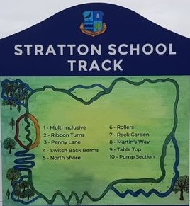 The track links to a cycle path which feeds directly from outside Stratton Primary School towards Bude town, so is very accessible to many without having to use cars. For those coming by car, the school has a large free car park which is little used outside school hours (and school drop-off/pick-up times). Access to that car park is via a tarmac lane leading due west from the A3072/A39 junction at Stratton.
A tarmac bridleway runs west from this car park and the entrance to the cycle track field is on the right a short walk/cycle-ride along this bridleway.
 Please note that scooters are not permitted as their hard wheels could damage the track's surface.
More information about the creation of this track can be found on the 'New developments' page.

 Bude Multi-use Trail
The 'Bude Multi-use Trail' is an almost entirely off-road well-surfaced route leading for almost 2 miles south along Bude valley. Much of it is based on the trail, built c2000 with European cycleway funding, to link Bude into National Cycle Network route 3.
With the majority of the route off-road, it provides less confident cyclists with a safe introduction to the variety of scenery that Bude offers (canalside, lake & marshes and farmland - even coastal bridleway on one return option).
Families with young children will probably be content to make the The Weir Bistro/Restaurant (with its associated playpark) their destination - returning by the same route. However, there are other options (mentioned below).
A map of the route (in .PDF format), with one possible detour off this, plus numbered route directions, is available as crescent-weir.pdf The map alone is visable here.

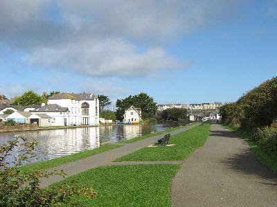 The route starts from beside the Tourist Information Centre in the Crescent Car Park in Bude. Take the wider tarmac path (not the narrower towpath) running south parallel to the canal. There is a sign near the start (see picture above) indicating this is the 'Bude Multi-use Trail'.
After 150m the cycleway veers left and goes across the old iron railway bridge over the river, then round the two cafés at Pethericks Mill (either behind or in front of them) before winding past a reed bordered lake and through Bude marshes along the left side of Bude valley. At one point it crosses a minor lane.
Shortly before the route reaches the A39, it joins the water treatment plant access road (along which some cars do park so that their occupants can walk/cycle to Bude).
 Just before this access road reaches the A39, a cycleway is signed off to the right; this has a tarmac path leading down to a massive concrete underpass under the A39. The concrete slope up from the other side of this underpass leads to a tarmac path on the grass verge of the A39, which is then used to reach a little gateway onto the quiet cul-de-sac Hele Road. Once through this gate, the signed route goes a short distance down this road, round a bend and over two little humped-back bridges.
Immediately after the second bridge is a wooden fingerpost on the right, with a 'Bude cycle link' sign directing you
 to take the track on the right leading to another underpass back under the A39 (please dismount when using this underpass). The route then passes over two wooden bridges to reach the end of the canal towpath.
 Cycling is prohibited on the towpath; instead go through the little gate on the left; this leads through a small car parking area to the concrete access lane to The Weir bistro/restaurant and playpark. Turn right onto this concete lane to go to The Weir.
Surface & inclines The surface is on tarmac or concrete the whole way from the Crescent car park to The Weir, apart from a very short stretch of gravel path from the gate after the two wooden bridges. There are four short inclines: a slight rise just before the water treatment works, another short rise up to where the cycleway goes off to the right just before the A39, the concrete slope up from the first underpass and a final slope on the concrete driveway up to The Weir.
Options When you have just crossed the two humped-back bridges (see above), instead of following the white 'Bude cycle link' signs to go to The Weir there are two alternative options. One is to continue for a few metres after the second humped bridge to turn left into a small car park and grassed area beside the old canal basin. Here you can rest before returning along the cyclepath back to Bude. On summer Sundays the Bude Canal & Harbour Society have a canal exhibition in the old wharf building at the end of the grassed area.
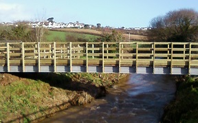 The other option is to explore a short, more-recent extension to the 'Bude Multi-use Trail'. Go straight on for a short distance to the T-junction at the end of the road, cross the road carefully and take the cycleway extension almost immediately opposite. Currently that new stretch passes over a new cycle/footbridge over the river and then leads to a point on the disused railway track. From that point it becomes a field where it is planned to install picnic benches at the end by the river (those benches and the grit track to them across that last field have yet to be funded).
A further option, if you do cross under the A39 to go towards The Weir, is to explore the grass track which runs as a link to Widemouth Bay; this is mentioned in the next (Whalesborough Farm loop) section and is detailed on the Local-links page.
The complete route of this Crescent-car-park to The-Weir ride is documented in more detail near the start of this website's Cycle routes page.
That page also details the option to take in a 2km ride across grassy coastal bridleway on the return to Bude. (Caution: that 'grassy coastal bridleway' option involves cycling up a mile long minor lane to get to the bridleway. It is an attractive & quiet lane but rather a long way for small legs - riding that grassy coastal bridleway may be easier in the reverse direction; see the second half of the 'Two Bude bridleways' section below for riding it that way).
An outline map of the 'Crescent-car-park to The-Weir' ride (also showing the grassy bridleway option) is available by clicking this link Crescent-Weir map and a .PDF copy of the map plus numbered route directions is available as crescent-weir.pdf.
A GPS track of the route is also available as crescent-weir-&-back.gpx on the GPS files page.
 Whalesborough Farm loop
Previous users of this website (and visitors to The Weir) will know that they used to have access to a very scenic cycleable loop right round the farm's land on a track stabilised with plastic-mesh under the grass; there were also two links across Whalesborough to Widemouth Bay.
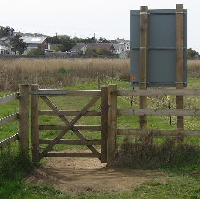
Sadly, much of that access is not currently available as the new owners of Whalesborough closed parts of the permissive paths on which these routes were based in 2023 (during major construction work).
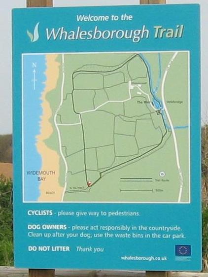
Just one of the cycling links from Helebridge to Widemouth Bay is currently available (the link shown as the the most southern route on the pictured map board). This is described in detail on the Local-links page. The uneven surface ideally requires wider (eg mountain-bike) type tyres.
Alternative grass based routes in the area are described below.
 Two Bude bridleways
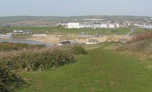
There is a bridleway running north for 1 mile from Bude's Crooklets beach to Northcott Mouth beach (and the rustic tea garden there). There is another bridleway running south for 1.2 miles from the canal lock gates to Upton Cross. For both these you will need to be on mountain bikes or e-bikes/hybrids with reasonably wide tyres, not roadbike tyres.
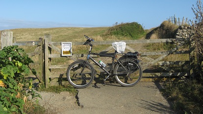 The northern bridleway starts from a gate at the top end of Maer Down Road. If you are starting from Crooklets car park, this gate can be accessed from the top inland corner of the triangle of grass north of Rosie's café (you can ride up the steep stoned track along the east side of this triangle or you can lessen the gradient by riding along the west side of the triangle and then back east along its top). Once at the top inland corner of the grass triangle, there is a little pathway there that leads through to near the top of Maer Down Road. The little gate onto the bridleway is at the very top of this road.
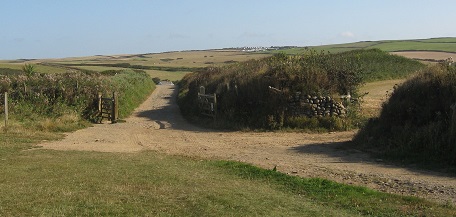 Once through the gate, the stoned bridleway runs directly north to Northcott Mouth. The stoned bridleway is quite bumpy; however, most of it is avoidable by riding on the grass slightly to the seaward side of the stoned track but you will need to return to the stoned track for a few metres each time the track passes through a stone Cornish 'hedge'.
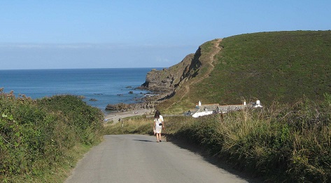 Shortly before you get to Northcott Mouth, the bridleway passes through another gate and onto a stoned track
that leads 180m to the road at Northcott Mouth (and a National Trust car park). From this point, the road descends quite steeply for 100m to its end at the beach.
Shortly before you get to Northcott Mouth, the bridleway passes through another gate and onto a stoned track
that leads 180m to the road at Northcott Mouth (and a National Trust car park). From this point, the road descends quite steeply for 100m to its end at the beach.
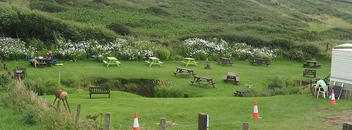 The rustic tea garden is a further 100m on the stoned track leading north from the beach. The 'garden' is a charming little valley beside the track with a stream running through the middle with a little wooden bridge and picnic tables either side. Drinks are served from a metal horsebox.
You can return to Crooklets the way you came ... or, for those who do not mind riding on quiet little lanes, you can take the road inland from the National Trust car park. This road climbs fairly gently over the hill and then descends to a junction (Grenville Gate). At this junction, turn right and take this attractive lane (past a holiday park, some old stables and a wildlife lake) to where it emerges near the south end of Mear Down Road. Turn left and ride 10m to the crossroads with Downs View; turn right into Downs View and cycle the 100m to Crooklets car park.
Surface & inclines The bridleway itself is quite stony; the grass alongside is usually quite easy to ride in summer but can get soft in places after prolonged rain. The bridleway undulates up and down by a few metres and slight climbs are required to get from the track onto the rideable grass path beside it. The two main climbs are getting up to the top corner of the grass triangle at the start and the short sharp climb back up from Northcott Mouth beach to the National Trust car park on the return.
The southern bridleway has longer climbs and, unless you are prepared to ride on some roads, is really about a very scenic linear adventure on coastal grass.
 The bridleway starts from a gateway in the little back lane between St Michaels church and the end of Breakwater Road. To access this gate, ride to the very end of Breakwater Road (don't take the part that goes to the lock gates) and turn left there to enter the back lane. Ride inland along this lane for 150m until you see a gateway on your right (there is a 'Bridleway' sign in the brambles just before it).
 Push your bike through this gateway and up the first steep 15m, then ride all the way up the hill (Efford Down) on the grass track, keeping the fence/hedge line just to your left. The gradient decreases about 1/3rd of the way up and there is a left bend at 2/3rds. You will come to a stone Cornish 'hedge' with two gateways about 10m apart; go through the righthand steel gate and ride on south, keeping the fence/hedge to your left. You will pass two wooden gateways in this leftside fence/hedge.
When you get to the 2nd of these wooden gates (about 200m after you passed through the 'righthand' gateway), the bridleway starts to diverge away from the fenceline. (look out for this divergence appearing as a slightly worn grass track).
Follow this; after riding a further 40m a valley ('Efford Ditch') opens up in front of you. Carry on riding the track worn in the grass down to the gateway you can see in the stone wall running along the bottom of the valley.
 Ride straight on southwards up the other side of the valley to a little gate at the top. At this point the bridleway is actually on the South West Coast Path for a short distance. Ride on for 150m to a point where there is a clear path in the grass leading diagonally inland away from the coast path (even walkers now have to take this path as the coast path is closed behind the cottages ahead due to a cliff-fall); this emerges onto the coast road near Upton Cross after 70m.
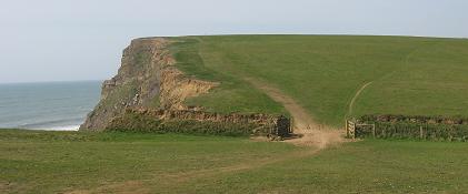
At this point you have three options: Option 1 is to retrace your grassy route (with quite a steep climb up out of the 'Efford Ditch' valley). Option 2 is to turn left onto the coast road (quite busy in peak holiday times or at daily commute times) and follow it back into Bude. Option 3 is to turn right onto the coast road and ride just 200m to the first junction (Upton Cross); there turn left and follow this minor lane all the way down to the foot of the valley where you will cross first the canal and then the river. 120m after the little river bridge, this lane crosses the Bude cycleway; turn left onto the cycleway and follow it all the way back to Bude's Crescent car park.
Surface & inclines The surface is fairly smooth short grass throughout the length of the bridleway; it is usually firm in summer unless there has been prolonged rain. This ride is a reasonable test of grass climbing ability, with two long ups and one long down on the outward route.
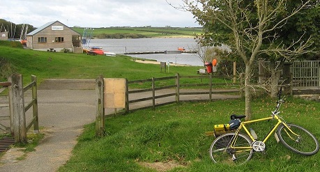 Tamar Lake circuit
South West Lakes Trust, in conjunction with 1SW, constructed a family-friendly green cycle track at Upper Tamar Lake in 2010. This is a grit-based loop of 5km, encircling the whole upper lake from the café back to the café.
It provides a wonderfully attractive route round the upper lake for both cyclists and walkers, and particularly for young families who wish to stay totally off-road.
 The loop starts from the northern end of the upper car park, runs round the edge of a camping field and then descends to be close to the lake shore (just beyond the lakeside area where the watersports activity centre is based).
The loop then follows close to the western shore of the lake (but keeping well clear of the anglers pitches) to pass the lakeside bird hide (inside is a list of all the species of birds that have been spotted from it). At the northern end of the lake the track enters some woodland and crosses a stream (that is actually the River Tamar) on a small level bridge.
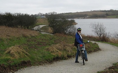
The way back follows the eastern shore of the lake, sometimes slightly screened from the lake by a thin belt of trees, and detours eastwards to go round the eastern spur of the lake. Finally it uses the wide walkway along the top of the dam to return to the car parks.
The café/restaurant is open throughout most of the summer months (but tends to close some weekdays so do check their 'TamarLakeCafe' Facebook page). There is a small childrens play area (slides etc) alongside the café. There is ample 'pay & display' parking near the café (or in a nearby overspill field car park) so those just wanting the lakeside circuit can take their bikes there by car.

To drive to the lake, take the A39 north from Bude to Kilkhampton; there turn east onto the B3254 (the lakes are well signed at this junction). Half a mile along the B3254, where it turns sharply right, go straight on instead (signed to the lakes) until you get to the next junction after 2 miles. There turn left and the entrance to Upper Tamar Lake is on your left after half a mile. Satnav postcode: EX23 9SB
Surface & inclines The track round the lake is grit surfaced, with some gravel showing through in places; the grit has stabilised well over the years. The carparks and the first bit of the track by the campsite are more gravelly and the dam walkway is stone blocks. It is all fine for bikes (even friends with thinner roadbike tyres are content to ride it) but the surface is not suitable for small wheeled scooters.
There are several small inclines round the track as it negotiates undulations in the lakeside topography. There is a descent from the camping field to the lakeside that is a bit gravelly so you may wish your child to dismount for this. There is a bit of a climb up from the dam via the carparks to the café - one way to lessen this is to ride out on the grass from the end of the dam, towards the watersports centre, then diagonally on the grass up to the upper car park.
Anyone fancy riding to the lake? There is an attractive quiet road circular ride from Bude or Stratton to Tamar Lakes - so, for families/groups with a mix of nervous and more competent cyclists, some can cycle to the lake while others meet them at the lake to cycle or walk round the lake.
The circular ride to Upper Tamar Lake is documented on this website's Cycle routes page. GPS tracks of the route are available via links on that page.
 Cookworthy Forest
This is another place you can take bikes to ride off-road.
Cookworthy Forest is a huge Forestry England conifer plantation on the A3079 about 4 miles east of Holsworthy. There are many wide grit-surfaced forestry tracks that are freely accessible to visitors (see Visitor information on
www.forestryengland.uk/cookworthy-forest). These tracks can be ridden on mountain bikes, hybrids and e-bikes.
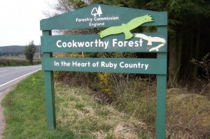 Access to the forest is via a ('Cookworthy Forest' signed) grit road that runs north off the A3079 about 2 miles south of Dunsland Cross (where the A3072 running east from Holsworthy meets the A3079). There is a free car park in the forest about 400m up the grit access road (Satnav Postcode EX21 5XJ or Grid Ref SS41740166).
The best route for young riders is probably the main west-east forestry road through the plantation leading to Halwill Junction where there is a general store, a pub and public toilets. The distance from the forest car park to Halwill Junction and back is approximately 4.5 miles (7.2km).
Route directions After parking, return to the grit forest road that you used to get from the A3079 to the forest car park, turn right and ride the short distance north to a multiway forest track junction. Veer right at the junction, going round the horizontal pole that blocks motor traffic (Note: do not take the half-right track with the 'No through way' notice).

Ride east (going straight across the first forest track crossroads after 1000m). After 2500m from this first forest track crossroads, the track enters a clearing where there is a signposted (narrow) permissive bridleway going off on the left and the main track veers right and down a slight slope.
 Keep to the main track (ignoring the narrow permissive bridleway). You are now on the path of the disused railway and passing through a Devon Wildlife nature reserve. Follow this path for about 1200m until it emerges through a gate onto the end of a quiet residential close. Ride along this (aptly named 'Beeching Close') until it reaches a junction; turn left and ride the short distance to where this close meets a road.
Turn right; the Junction Inn pub (Tel: 01409 221239) is a short distance (about 40m) down this road on the lefthand side. Slightly further on down this road are some shops. The pub has outdoor terraces and a pub garden.
Surface & inclines The forest roads are a white grit surface which is slightly* rough to ride but suitable for all sizes of pneumatic tyres and wheels (* we found it was a little smoother to ride where the path was covered in pine needles). The bridleway along the old railway path is also quite smooth.
The route is effectively following the old Halwill Junction - Bude railway line, or on a forest track running parallel to the old railway; hence, while there are very slight inclines, the path is effectively flat the whole way, apart from the short slight incline down where the route descends from the forest track to the old railway path. Note however, that the alternative tracks you can take in the forest do have significant inclines (see the Extra/alternative routes section below).
Extra/alternative routes On the way back there is the ability to vary the last part of the route back to the car park. At the crossroads you encountered about 1000m from the start of the ride, turn left and ride slightly downhill and south for about 400m, then follow the track as it veers right (west) and ride it UP to a major track t-junction. This is the junction you crossed in your car just before turning into the car park. Turn right here and then right again into the car park. (Note the word "UP"; you rode downhill for 400m so there is a long gradual climb back up to the t-junction).
An extra excursion is to ride the narrow permissive bridleway that goes off to left of the main track (as mentioned in the Directions above). This is a scenic little path (you will need to ride it single file). It climbs very gently north for about 500m, then joins a farm track running east for 700m to Chilla Chapel where it joins the road that runs north from the pub. If you are happy to ride a fairly quiet and pretty straight and level road, you could turn right onto the road and ride it for 1600m back to the pub;
 if not, you would need to return via the permissive bridleway you have just taken.
Caution: I mentioned that the path is narrow; when I took a group there in summer I rode it in advance to trim any brambles that were blocking the path.
There are two long forest tracks that go off from the main forest track described in the 'Directions' above. Be warned - both these tracks are not necessarily family riding; both involve going over a quite substantial hill resulting in about 120m of climbing there and back. One runs northwest from the first multiway junction you come to on the 'Direction' route above. This gives a longest 'there and back' ride of about 3Km. The other is a forest track that goes north from the crossroads encountered 1000m along the main 'Directions' ride. It twists west then north then northeast to reach the A3072 near Garlands Farm Equestrian Centre. The A3072 is a busy 60mph main road, so family groups would probably want to return on the same forest track; a 'there and back' ride of 9Km with a substantial climb on the way back.
 Holsworthy cycleways
There are off-road cycleways on the approach to Holsworthy from the east and on the approach from the west. Most of the eastern one, and all of the western one, are off-road sections of National Cycle Network route 3 (NCN3).
The eastern cycleway is possibly the more appropriate as an excursion route for young cyclists - since there are two points on it where there is some car parking space, and it is a longer route.
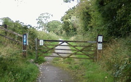 This eastern cycleway starts from a point on the eastbound A3072 300m up the hill from the A388/A3072 junction just south of Holsworthy town. The gateway to the cycleway is on the east side of the road, opposite a gateway to the now-closed wood-cabin café/restaurant.
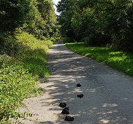 The cycleway runs along the route of an old railway line with virtually no gradients for 2.5 miles (4Km) to Hollacombe. It is totally rural, running in a corridor of trees/hedges for almost the entire way, with frequent views into the valley to the south. There is one section where it is on compacted hardcore/gravel for 1/2 mile (as it passes some fishing lakes); otherwise it is on tarmac.
It crosses one minor road after 1.8 miles.
The cycleway runs along the route of an old railway line with virtually no gradients for 2.5 miles (4Km) to Hollacombe. It is totally rural, running in a corridor of trees/hedges for almost the entire way, with frequent views into the valley to the south. There is one section where it is on compacted hardcore/gravel for 1/2 mile (as it passes some fishing lakes); otherwise it is on tarmac.
It crosses one minor road after 1.8 miles.
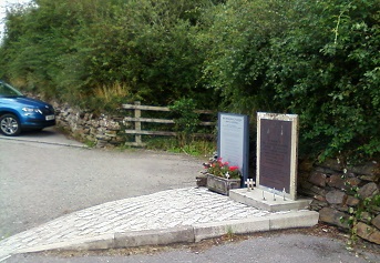 One way to access the cycleway is to take a car to where it crosses the minor road; there is a memorial to an RAF aircraft crash at this point. Near the memorial there is a small amount of parking just off the road. To get there, take the A3072 for 2 miles east from Holsworthy and turn right at the third junction - signed Hollacombe (the first two junctions are left turns). The aircraft memorial is on your left after 350m.
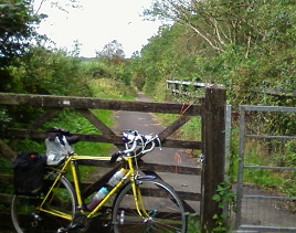 From there you can take the cycleway in either direction. If you cycle through the gate beside the aircraft memorial this path (tarmac all the way) takes you 0.7 miles to a gate onto a lane at Hollacombe (the hamlet of Hollacombe is 200m to the right down this lane). You will probably want to return via the way you came; so this is a short attractive cycle (on a tarmac surface the whole way - also suitable for children on scooters).
The other route on the cycleway (you might want to do both) is to go through the gateway on the side of the road opposite to the aircraft memorial.
This part of the cycleway starts and finishes on a tarmac surface but has the 1/2 mile (800m) hardcore/gravel section in the middle.
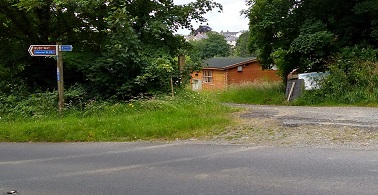 This direction takes you 1.8 miles to the gateway on the A3072 (opposite the gateway to the now-closed wood-cabin café. There is a bit of possible parking off the road on gravel (2 or 3 cars) just north of the gateway entrance to the café. There is also possible parking in the layby a short distance further up the A3072.
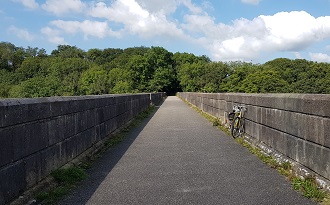 The western cycleway starts just south of Holsworthy town centre along the massive old Derriton railway viaduct over the River Deer. There is no sensible parking near either end of this cycleway, and the road down to it from the east end of the town square is probably too busy for young children.
However, it can be accessed from the town square by taking the little lane that runs out of the southwest corner of the square, passing in front of the McColl's shop and turning left into the bollarded alleyway just beyond the shop. From this point the route to the start of Derriton viaduct is via residential roads and a short cycleway, all signed with blue National Cycle Network NCN(3) markings. Note that there is a large amount of 'pay & display' parking (plus the Holsworthy Information Centre) in the Manor car park (Satnav postcode: EX22 6DJ) located just off the town square. The small exit from the northeast corner of the car park comes out right opposite the bollarded alleyway.
 After crossing the viaduct, this cycleway runs for 0.8 miles west along the rural tree-lined route of the old railway, passing one of the NCN Millennium Mileposts and finishing at a gateway onto a concrete lane (Lamb Lane).
 The surface is tarmac and there are no climbs apart from the short steep curving access up to Derriton viaduct and a slight rise up to the final gateway. Cycling beyond this point* involves riding on roads, so young cyclists will probably return to Holsworthy by the same cycleway.
[* The concrete part of Lamb Lane runs south to the Holsworthy-to-Pyworthy road (Lamb Lane also runs north to the Rydon Inn; however the surface on this unsurfaced northern lane is only really suitable for mountain bikers). NCN3 continues to Bude through Pyworthy but is all on-road apart from the 1.5 mile stretch near Bude.]
 Camel Trail
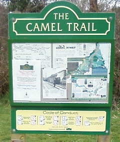
This is the well known North Cornwall trail running for about 20 miles on old railway paths.
The best known section is the iconic and very scenic route running alongside the Camel estuary from Padstow to Wadebridge. However, this section gets very, very crowded in peak holiday season with long waits for almost everything.
The section from Wadebridge to Bodmin is also busy, albeit a bit less hectic.
By far the quietest section is the northern spur, running 8 miles from Wenfordbridge to the junction where it meets the main Bodmin - Wadebridge route of the Camel Trail near the Borough Arms pub, west of Bodmin.

This section is very scenic and winds from Wenfordbridge along and 'down' the Camel river valley.
The 'down' is a very gentle railway gradient so fairly imperceptable.

There is a reasonably large free carpark at Wenfordbridge with an attractive logcabin café/restaurant alongside.
Snailspace Café - Tel: 01208 851178 Satnav postcode: PL30 3PN. email: info@snailspacecafe.co.uk www.snailspacecafe.co.uk
While some Bude cyclists do ride * from Bude to Snailspace Café, most families will go there by car. ( * a 60+ miles route there and back, using the very attractive National Cycle Network route 3 to get there, is documented on the Cycling routes page of this website.)
Going by car, you take the A39 from Bude to Camelford and, just south of Camelford (at Valley Truckle) turn left onto the B3266 towards Bodmin. Take the B3266 for 3.5 miles then, as the B road sweeps round to the right, turn left (signed 'Coombe Mill 1') then almost immediately veer right (ignoring the left turning to Tuckingmill) and continue downhill for 1.5 miles to Wenfordbridge. If you miss this turning off the B3266, you will shortly see signs on the right for St Tudy; take the first turning on the left (signed 'St Breward 3') and this too can take you to Wenfordbridge; albeit you will need to turn left at the crossroads you encounter about half a mile after leaving the B3266.
 If you get down the Camel Trail as far as the junction where the northern spur meets the main Bodmin to Wadebridge trail, there is a good pub (the Borough Arms) adjacent to the trail near this junction. Turn right onto the main trail (towards Wadebridge). Shortly you will pass under a bridge and will see an old platform on the right side of the trail (Dunmere Halt); the path up to the pub is on the left side of the trail at this point. There is a large parking area at this access point to the Camel Trail and the pub has an outdoor play area and plenty of outdoor seating. For more information visit https://theborougharms.com/ Satnav postcode: PL31 2RD.
Surface & inclines The surface on the section of the Camel Trail between Wenfordbridge and Dunmere Halt is grit. It is normally a good firm surface but can have leaves and some damper patches in winter. The old railway follows the river so the drop is very shallow and consistent (about 5m per mile). There is an incline up over the last 600m to join the main east-west part of the Camel Trail near Dunmere Halt.
 Tarka Trail
This is another well known cycling/walking trail built on a disused railway line.
The northern section runs 6 miles southeast from Braunton to Barnstaple, for the most part beside the River Taw estuary; at Barnstaple the route either goes through the town (mainly off-road) or there is the well-signed alternative to ride over the river via the huge Taw Bridge (on a very wide pavement where cycling is encouraged).
The central section runs westwards across the salt marshes along the other side of the River Taw estuary to Instow (6.5 miles) and then south along the side of the River Torridge estuary to Bideford (a further 3 miles), with wide open views of the estuary and coastal marshes/farmland for much of the way.
The railway path runs in a leafy railway cutting behind the town of Instow, but there is easy access to the town and its shops/refreshments from the level crossing just south of the town. At Bideford the Trail passes through the old Bideford station (the opposite side of the river from the main town); in summer the old railway carriage here serves drinks & snacks, there are several pubs near the station and also Bideford Bicycle Hire - Tel: 01237 424123 Satnav postcode: EX39 4DR https://www.bidefordbicyclehire.co.uk/.
The southern section runs 15 miles from Bideford to Meeth. This is flat for 1.2 miles to the long bridge over the River Torridge, then starts to climb gently for most of the next 8 miles with several views from bridges of the river Torridge meandering below.
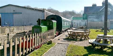 4 miles up from Landcross is the old station (for Great Torrington) at Rolle bridge; here there is the 'Puffing Billy' pub (with extensive outdoor garden/seating) and, on the opposite side of the track, Torrington Cycle Hire - Satnav postcode: EX38 8JD https://torringtoncyclehire.com/ - and refreshments.
2 miles beyond Puffing Billy, at Watergate Bridge, the Trail surface changes; it has been tarmac all the way from Braunton but onwards to Meeth it is grit surfaced.
 There is a trailside café based in an orchard with extensive outside seating and wooden buildings at East Yarde a further 2.8 miles south of Watergate Bridge. www.yarde-orchard.co.uk Tel: 01805 621111 Postcode: EX38 8QA.
Summer quietness Just like the Wadebridge to Padstow section of the Camel Trail, the parts of the Tarka Trail alongside the Taw and Torridge estuaries tend to be busy in peak holiday times. The Trail south from Bideford tends to be quieter and, as most of the cyclists using that stay on the Bideford to Puffing Billy section, the Trail south of Puffing Billy is even quieter. If you are taking young children up from Bude to enjoy the Tarka Trail, that southern part may be best.
There is a small free car park at Watergate Bridge, another small free one where the road crosses the trail just north of Petrocstowe, and a substantial amount of 'pay&display' parking at Puffing Billy (there is very limited parking at East Yarde). Watergate Bridge can be accessed by taking the B3227 from Stibb Cross (the junction of the A388 & B3227), Puffing Billy at Rolle Bridge can be accessed by going further north on the A388 to Frithelstock Stone and turning right there for Frithelstock and Rolle Bridge. Your Satnav may suggest other options.
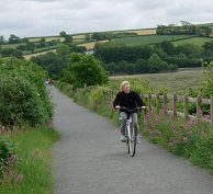 Surface & inclines As mentioned above, the surface is tarmac all the way from Braunton to Watergate Bridge; south of there it is grit. The gradient south of Landcross is mostly a railway climb, sometimes almost flat but at other points a little steeper; it climbs about 100m in 8 miles and flattens off about 1 mile north of the Yarde Orchard café at East Yarde. The estuary parts of the Tarka trail are all flat, apart from the inclines up from the Trail to access the Taw Bridge crossing at Barnstaple.