Atlantic Trail - cycling routes
This page has descriptions of cycle routes radiating out from Bude, or in the area surrounding Bude. For some of these routes there are links to more detailed descriptions; also, for many routes, GPS tracks are available (via a separate page) enabling the route to be viewed against a map.
More routes will be added as these are documented or new ones are developed.
Gentle / beginner routes
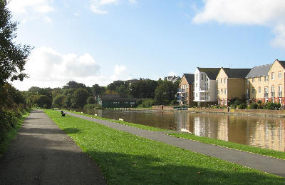
 A key 'gentle' route is the 2 mile off-road cycleway leading south, initially beside the Bude Canal, from Bude's Tourist Information Centre in the Crescent car park.
This has a tarmac surface and is almost entirely level ground apart from two small rises. It is signed as National Cycle Network route 3 (NCN3).
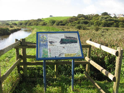
The cycleway runs on a broad multi-use path parallel to the canal towpath for a short distance, then veers left to cross the river Neet on the old railway bridge (with nearby interpretation board), goes round the front of the cafés and salons at Pethericks Mill and then crosses the flood defence bank into Bude Marshes.
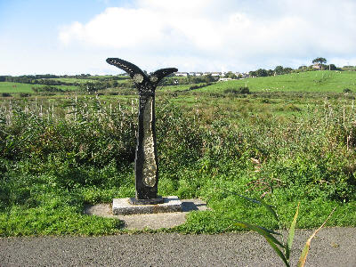 It then winds through the marsh area (watch out for a heron or egret beside the water or, very occasionally, the electric blue flash of a kingfisher),
round the end of the rugby field past the Millennium cycleway post, then ascends slightly back onto the railway embankment.
It then winds through the marsh area (watch out for a heron or egret beside the water or, very occasionally, the electric blue flash of a kingfisher),
round the end of the rugby field past the Millennium cycleway post, then ascends slightly back onto the railway embankment.
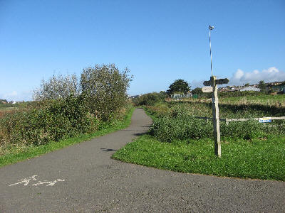 After a further half mile it crosses a rural lane and then runs further south to join the access road to the water treatment works. This access road leads to the A39. The cycleway used to cross the A39 via a traffic island at this point; however, the route now takes a tarmac path off to the right about 30m before the A39 and goes under the A39 via an underpass.
Once on the east of the A39, the cycleway runs on a tarmac path along the grass verge until it passes through a gateway onto the old, now cul-de-sac, road at Helebridge. The route goes right onto this road, round a bend and over two old stone 'humped' bridges.
Immediately after the second 'humped' bridge there are various options:
For those wanting to explore longer on-road rides, NCN3 now continues on minor roads and lanes, by going to the T-junction ahead, then up the hill to Marhamchurch and then east to Holsworthy and thence north via Sheepwash to join the Tarka Trail near Petrocstowe.
From Marhamchurch there is also another National Cycle Network route (now numbered as NCN304) which provides an easier inland variant to the scenic but hilly coastal part of NCN3 that goes directly south from Bude. NCN304 goes south via Week St Mary to rejoin the main southbound NCN3 before Hallworthy. That southbound NCN3 then runs across a beautiful stretch of Bodmin Moor to join the Camel Trail at Wenfordbridge and thence on to Bodmin.
These longer NCN routes are described in the 'long distance cyclists' section of this webpage.

However, those who are only out for a gentle ride have several options:
 # At that point they can follow a wooden fingerpost sign saying "Bude cycle link" pointing right immediately after the second humped bridge.
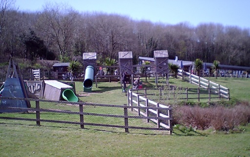
This takes them under the A39 via another underpass beside the river to visit the nearby Weir Coffee-house/Bistro/Nature-centre/Play-area.
# At that point they can follow a wooden fingerpost sign saying "Bude cycle link" pointing right immediately after the second humped bridge.
This takes them under the A39 via another underpass beside the river to visit the nearby Weir Coffee-house/Bistro/Nature-centre/Play-area.
# Alternatively, turn left after the second humped bridge into a small car park and grassed area beside the old canal basin for a rest before returning along the cyclepath back to Bude.
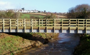 # Another option is to continue for a few more metres to the T-junction at the end of the road, cross the road carefully and cycle a bit further along the short (dead-end) stretch of new cycleway. Currently that new stretch passes over a new cycle/footbridge over the river and then leads to a point on the disused railway track. From that point it becomes a field where it is planned to install picnic benches at the end by the river (those benches and the grit track to them across that last field have yet to be funded).
# Yet another option, for slightly more adventurous cyclists, is to follow NCN3 up into Marhamchurch (where there is a pub, and a community shop serving coffee, cake etc) and then follow quiet country roads north to Stratton and thence back into Bude via a tarmac bridleway and residential 'home zone' roads. (This route uses the 'Marhamchurch to Stratton' and 'Bude to Stratton' inter-village links documented later on this page.) A map (and details of the route) are available from the Bude Bike Hire routes section below as the 'Farms & Villages' route.
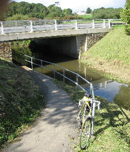
The first of those four options is the path off to the right just after the second humped bridge
(following a white 'Bude Cycle Link' sign to go back under the A39).
The path alongside the river in the underpass is narrow. Cyclists should dismount and push their bikes in this short underpass section.
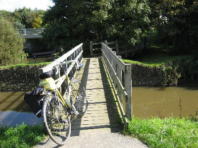 Once back on the west side of the A39, this path crosses two small wooden footbridges to reach the canal towpath. Please do not turn right onto the towpath; the towpath is narrow and cycling on it is not permitted.
Instead, from this point, turn left through a small gate onto a path that leads to the concrete access lane to 'The Weir' and Whalesborough farm. Turn left onto this concrete access lane.
Once back on the west side of the A39, this path crosses two small wooden footbridges to reach the canal towpath. Please do not turn right onto the towpath; the towpath is narrow and cycling on it is not permitted.
Instead, from this point, turn left through a small gate onto a path that leads to the concrete access lane to 'The Weir' and Whalesborough farm. Turn left onto this concrete access lane.
The Weir Coffee-house/Bistro/Nature-centre/Play-area is on the right about 200m along this concrete access lane.
The shortest way to cycle back to Bude is to return along your outward route.
However, there is an alternative that gives the option of riding the last 2km on a delightful grassy bridleway over the clifftop Efford Down. A description of this alternative (with photos) is given on a separate 'Efford Down return' page.
Note: this alternative (to riding all the way back to Bude on the multi-use trail) involves cycling 1600m up a very minor lane (so not entirely traffic free and a long stretch for small legs), then 100m on the coast road before the 2km ride on grassy bridleway all the way back to Bude.
An alternative option for those wanting to try this grassy coastal bridleway might be to ride it in the opposite direction (starting from Bude) meaning this long lane would be downhill - with the climbing done on the grassy bridleway slopes.
The route for riding the grassy bridleway in that direction is given in the second half of the 'Two Bude bridleways' section on the 'Children's routes' page of this website.
An outline map of the 'Crescent-car-park to The-Weir' ride (also showing the return options) is available by clicking this link
Crescent-Weir map.
A .PDF copy of this map, with numbered route directions, is available by clicking this link Crescent-Weir PDF.
There is also a GPS track of this ride available as crescent-weir-&-back.gpx. This can be viewed against an OS map as described on the GPS files page.

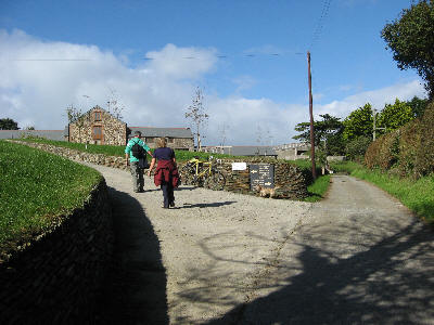
Note:
Those who have cycled to The Weir in previous years will know that The Weir's concrete access lane was also the start of a permissive bridleway and a Sustrans link route providing a route to the coast road 2 miles south of Bude.
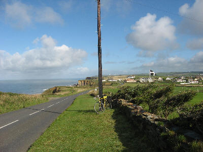 This provided access to a very scenic link back towards Bude to rejoin either the multi-use trail or easily access the grassy bridleway across Efford Down.
They will also know that there was a permissive grass/earth cycle track round the Whalesborough farm land, with a spur off this giving cycleable access to Widemouth Bay. 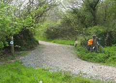 Most of that loop had a plastic-mesh base under the track and was part-funded with European grant money.
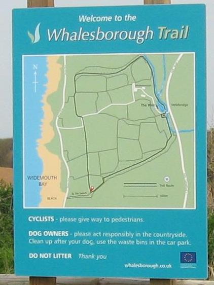 Sadly, much of that access is not available as, from April 2023, the new owners of Whalesborough closed parts of the permissive paths on which these routes were based (during major construction work).
Just one of the cycling links from Helebridge to Widemouth Bay is currently available (the link shown as the the most southern route on the pictured map board). This is described in detail on the Local-links page.
Grass and soil coming up through the plastic mesh have made parts of this link quite lumpy (and quite muddy after prolonged rain and in winter). It is a very scenic and interesting route; however, the uneven surface ideally requires wider (eg mountain-bike) type tyres.
Northcott Mouth beach
This is another shortish ride (c5 miles), also more suited to less confident cyclists.
It starts from the Crescent car park, goes to the Summerleaze car park via the little footbridge over the river, uses the exit ramp of that car park to get to Sainsburys, goes down the hill past the entrance to Crooklets car park and then takes an attractive minor lane route out to Bude's northern beach at Northcott Mouth.
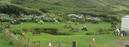 Refreshments are available at Northcott Mouth from the SIP & SEA rustic tea-garden.
 This is just 200m further north up a stoned track in a charming little valley with a stream and picnic tables either side, serving from a converted horsebox.
An alternative route back to Crooklets via a stoned bridleway (much of which can be ridden on grass) begins from beside Northcott Mouth's National Trust car park (which is just up the road south of the beach).
Apart from the footbridge and the alternative bridleway, all of this route is also used by cars; however, much of it is through areas also used by pedestrians and on very minor lanes.
A map (and details of the route) are available from the Bude Bike Hire routes section below as the 'Town & Beaches' route. Even more detail of the route is given in the 'Two Bridleways' section of the 'Children's routes' page of this website.
Bude Bike Hire routes
 Bude Bike Hire has now closed but several of its documented routes are still valid. It was established in 2010 in the new centre at Pethericks Mill, a short distance along the multi-use trail from Bude. Later, from April 2019 until it closed after the 2022 season, that bike hire was based at Whalesborough Farm, just off the entrance lane up to the Weir bistro/café/nature centre.
 They had maps and descriptions of some local routes.
These were available in printed form when hiring bikes from the hire centre but also could also be freely downloaded from the internet.
With the closure of Bude Bike Hire, a new bike hire (with E-bike hire available) has opened in Bude, based at the RideIt bicycle shop in Lansdown Road.
Pending that new bike hire creating routes from Bude, five of the Bude Bike Hire routes (based on the original Pethericks Mill Location) are listed below, each with a link to a downloadable copy.
- Town & Beaches This is a 5½ mile route from Pethericks Mill to Bude, over Nanny Moores Bridge, past Summerleaze and Crooklets beaches, to the northern beach at Northcott Mouth (with an option to ride Crooklets to Northcott via the coastal bridleway).
(see detailed route description)
- Farms & Villages This 5½ mile route strings together three inter-village links (between Bude & Stratton, Stratton & Marhamchurch and Marhamchurch & Bude as documented in the 'Local Links' section of this webpage) to create a scenically varied loop.
(see detailed route description) - Week St Mary 14 miles. Week St Mary is a village (with community shop, pub and toilets) on the inland southbound National Cycle Network route about seven miles from Bude. This route (hilly in places) is also described further below.
(see detailed route description) - Tamar Lakes This is a picturesque 17 mile loop, mainly on minor roads, to Upper Tamar Lake, where there is a Watersports Centre, a café and an easy circular off-road 5km cyclepath round the lake. These facilities and this route are also described below.
(see detailed route description) - Morwenstow 17 miles. This follows the Town & Beaches route to Northcott Mouth, then uses bridle paths to Coombe, then lanes to Morwenstow. Return via Woodford, Stibb and Poughill. (Seriously hilly both ways so e-bike recommended). The hamlet of Morwenstow has a 13thC pub, the Rectory Tea Rooms and an historic church. This route has been very popular with those wanting a little more adventure or challenge.
(see detailed route description)
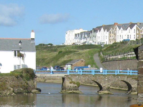
Links between local villages
This section lists some off-road or quiet-road links between Bude and nearby settlements.
These are documented on a separate Local Links page.
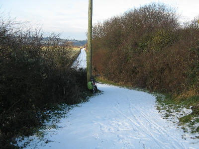 Clicking any of the links below will take you to the relevant route description on that page:
Bude to Stratton
Marhamchurch to Bude
Marhamchurch to Widemouth Bay
Marhamchurch to Stratton
Stratton to Flexbury
Poughill to Crooklets
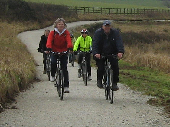 Tamar Lakes ride (& lakeside circuit)
South West Lakes Trust, in conjunction with 1SW, constructed a family-friendly green cycle track at Upper Tamar Lake in 2010. This is a grit-based loop of 5km, encircling the whole upper lake from the café back to the café.
It provides a wonderful route round the upper lake for both cyclists and walkers, and particularly for young families who wish to stay totally off-road.
There is ample 'pay & display' parking near the café so those just wanting the lakeside circuit can take their bikes there by car. If planning to use the café, do check their opening days/hours before you go facebook.com/TamarLakeCafe
 Fancy riding to the lake? There is an attractive quiet road circular ride from Bude or Stratton to Tamar Lakes - so, for families/groups with a mix of nervous and more competent cyclists, some can cycle to the lake while others meet them at the lake to cycle or walk round the lake.
Caution: Some descriptions of this ride mention a brief section on the A39 near Kilkhampton, this can be avoided by taking the driveways through Penstowe Park Holiday Village.
This circular ride from Bude to Tamar Lakes and back to Bude can be done as either a clockwise or anti-clockwise loop. A map (and details of the clockwise direction) are available from the Bude Bike Hire routes section above.
Alternatively, a more detailed description of the loop in both directions is available.
(see detailed route description)
GPS tracks of two possible routes from Bude Crescent Car Park to Upper Tamar Lake are given on this website's 'GPS files' page. One goes via Stratton (bude-tamarlake.gpx), the other via Kilkhampton (bude-kilk-tamarlake.gpx). That 'GPS files' page also gives a link to one (of many) websites that enable such GPS tracks to be viewed against a map. Either of these two routes can be ridden in the reverse direction to serve as a return route.
 Bude - Week St Mary loop
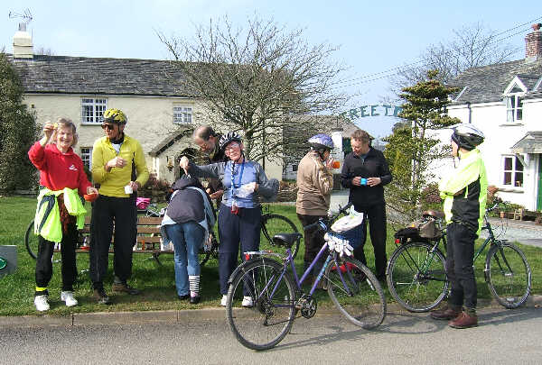
Week St Mary is a charming Cornish settlement with village shop (by the village green), nearby church, public toilet, and a pub. (village website:
www.weekstmaryvillage.co.uk)

The outward route to Week St Mary is on National Cycle Network route 3 (marked with blue NCN cycle signs and a red 3) as far as Marhamchurch. Between Marhamchurch and Week St Mary it follows NCN304. The 15 mile (24km) loop is very scenic but does involve several hills. The loop uses minor roads/lanes plus the bude cycleway.
It starts at the Tourist Information Centre in Bude's canal-side Crescent car park, and runs south on the Bude cycleway, goes past River Life café and on to join minor roads at Helebridge (thereby passing near the Weir). From there it goes up the hill to Marhamchurch (where there is a community shop - which can provide coffee and has an associated public toilet) and on south on the same road for 7.5km to Week St Mary.
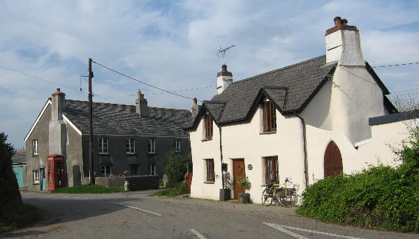 You can return to Bude either via your outbound NCN304/3 route or take a very scenic (equally hilly) alternative route back to Marhamchurch on very minor roads via the hamlets of Bakesdown, Titson and Harlake. A map (and details of the route) are available from the Bude Bike Hire routes section above
or see detailed loop description
 Traffic-free routes
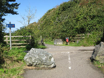
The four traffic-free routes directly linked to Bude are:
- The Crescent car park to The Weir multi-use trail (described in the 'Bude cycleway' section on the Children's Routes page and also described near the start of this Routes page).
A minor part of this at the Weir end has occasional traffic. - The grassy bridleway from Crooklets going north across Maer Down to Northcott Mouth (described in the 'Two Bridleways' section on the Children's Routes page and also briefly described in the 'Northcott Mouth' section of this page).
For more adventurous cyclists, this can be extended by taking the track/path further north (cyclists permitted) from Northcott Mouth, past the Rustic Tea-garden to the Sandymouth road and even crossing that road to go further on the bridleway beyond (this is documented as part of Morwenstow route in the 'Bude Bike Hire routes' section of this Routes page). - The grassy bridleway going south across Efford Down from near the sea lock to Upton (described in the 'Two Bridleways' section on the Children's Routes page and also described, albeit in the other direction, as an alternative route back from the Crescent to Weir route on this Routes page).
- The cycling track, with its banked bends and optional humps and excursion into the woods, right round the playing field of Stratton Primary School.
This is open to the public outside school hours and is described in the 'Stratton School track' section on the Children's Routes page.

For those able to take their bikes somewhere by car, there are three other reasonably local traffic-free locations:
- One is the scenic grit-surfaced loop right round the perimeter of Upper Tamer Lake, returning to the café area via the walkway over the dam
(this is described in the 'Tamar Lake' section on the Children's Routes page and also mentioned in the 'Tamar Lakes' section of this Routes page). - Another is Cookworthy Forest (about 5 miles east of Holsworthy) where cycling is allowed on the well-surfaced (grit/gravel) forestry tracks
(this is described in the 'Cookworthy Forest' section on the Children's Routes page and also described in the 'Cookworthy Forest' section of this Routes page). One track leads east emerging near the Junction Inn at Halwill Junction. - The third is that there are shortish tarmac-surfaced multi-use tracks going east and west from Holsworthy along disused railway lines
(These are described in the 'Holsworthy cycleways' section on the Children's Routes page).

For those prepared to drive further, there are three major off-road trails
(all part of the National Cycle Network):
- The nearest is the Camel Trail. The closest access point is at Wenfordbridge where there is a free car park and the wood-cabin Snailspace café (described in the 'Camel Trail' section on the Children's Routes page).
- Going north, there is the Tarka Trail (described in the 'Tarka Trail' section on the Children's Routes page). The fastest way to access it is to take the A39 to Bideford where the Trail uses the old railway line north of the river. Another access point is at Watergate Bridge (on the Stibb Cross to Gt Torrington road) where there is a small car park. A third access point is at Puffing Billy / Rolle Bridge (just south west of Gt Torrington) where there is a pub and a cycle hire beside the Trail.
- Further away still is the Granite Way at Okehampton. This uses the old railway line going south, passes over the impressive Meldon Viaduct and then uses a new cycleway to get to Lydford.
 Coffee stops
Many cyclists like to pause at a café mid-ride, so cafés/farmshops, accessible via rural lanes, create extra ride opportunities for such cyclists.
[Note that there are a wealth of refreshment locations in and around Bude; this website will concentrate on ones that are not in towns and which can be reached by routes with little/no use of main roads.]
Some such cafés are already mentioned on this website. The intention is to add more.
Links to those already documented are listed below:
- Weir Coffee-house/Bistro at Helebridge. 2 miles from Bude.
Weir Coffee-house/Bistro detailed near the start of this 'Routes' page - SIP & SEA rustic tea garden at Northcott Mouth. under 2 miles from Bude.
near Northcott Mouth beach detailed as the 2nd section of this 'Routes' page - Community-run village shop at Bridgerule. 6 miles from Bude.
Bridgerule Village Shop mentioned in Holsworthy section of this 'Routes' page - The Market Café 1 mile north of Holsworthy. about 12 miles from Bude.
The Market Café mentioned in Holsworthy section of this 'Routes' page - Café at Upper Tamar Lake. about 10 miles from Bude.
Upper Tamar Lake detailed 1/3 way into this 'Routes' page - The Hive Café at South Worden Farm (beyond Tamar Lake). about 12 miles from Bude.
currently CLOSED - may re-open if sold - Willow Tree Café near North Petherwin. about 15 miles from Bude.
Willow Tree Café detailed below on this 'Routes' page - Blackberry Farm Shop near Milton Damerell. about 15 miles from Bude.
Blackberry Farm Shop detailed below on this 'Routes' page - Yarde Orchard on the Tarka Trail. about 25 miles from Bude.
Yarde Orchard detailed near the end of this 'Routes' page - Snailspace Café at Wenfordbridge on the Camel Trail. about 29 miles from Bude.
Snailspace Café detailed near the end of this 'Routes' page

 Quiet road circular rides & groups
There are a multitude of quiet
lane/road circular rides that can be
taken from Bude. Some will be
added to this website in due course.
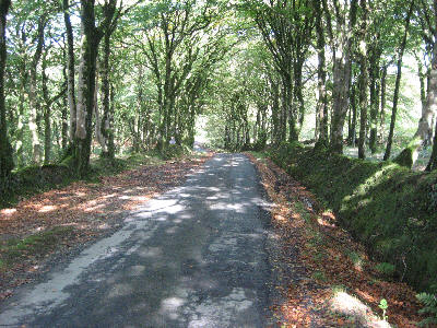
One way to access them is to join up with either of the two groups of cyclists who go out on a weekly basis. These are not organised rides, just small groups of friendly cyclists who meet up to ride together and newcomers/visitors are welcome to join them.
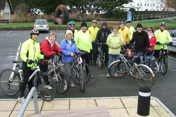 One group meets outside the Tourist Information in the Crescent car park most Tuesdays. The riders meet here for 10am.
Many of this group are retired and they ride at a reasonably leisurely pace, usually cycling 10-20 miles.
Most have e-bikes. Usually they stop for a coffee break midway at a suitable café.
 .
.
This group also occasionally organise a day-long scenic outing, sometimes starting at a location other than Bude (eg on Bodmin Moor, the Hartland peninsula or Jamaica Inn, or even further afield - Tavistock moorland or Exe Estuary).
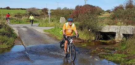
 The Bodmin Moor excursion is a very scenic 25 mile ride taking in wonderful scenery over the moors plus a short stretch of the Camel Trail (with several possible refreshment stops, including Snailspace café). As the start/finish location is only 15 miles from Bude and just off the A39, it makes a wonderful day trip for those who can take their bikes by car from Bude. Details are documented here
 Another group may go a bit faster and a bit further but is still very much a social ride on minor country roads/lanes.
They too now meet outside the Tourist Information Centre each Sunday and start about 10am. They tend to ride for a couple of hours (occasionally a bit more if those present have the energy and time to do that). Again. they mostly have e-bikes and they too usually stop at a café for a coffee.
Another group may go a bit faster and a bit further but is still very much a social ride on minor country roads/lanes.
They too now meet outside the Tourist Information Centre each Sunday and start about 10am. They tend to ride for a couple of hours (occasionally a bit more if those present have the energy and time to do that). Again. they mostly have e-bikes and they too usually stop at a café for a coffee.
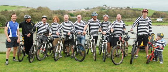
There is also a predominantly off-road mountain bike club - Bude Mountain Bike Riders - also called Dept. 26.
They have Wednesday evening and Saturday afternoon social rides.
Both these rides start from the Ride It cycle shop in Landsdown Road, Bude.
Dept. 26 also ride a special forest trail they have built, open only to their members.
The phone or text contact number for Dept. 26 is 07832 654 221
More details are available on http://dept26.blogspot.com Their Facebook pages are www.facebook.com/groups/dept26 and www.facebook.com/dept26.
Holsworthy (about 22 miles there & back)
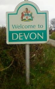
One ride the Tuesday group enjoy quite frequently is to cycle to Holsworthy and back. Beware; this ride takes you into a foreign country - across the Cornwall border, and the River Tamar, ... into Devon!
The outward route is normally entirely along National Cycle Network route 3 (NCN3); so leaving Bude's Crescent car park along the off-road multi-use path near the canal, veering left to follow this path (not the towpath), then round the front of the River Life café and eastwards on the off-road path all the way to Helebridge (crossing under the A39 via the path's underpass).
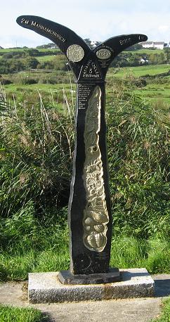
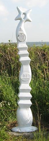
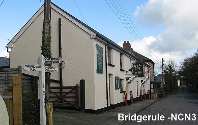
 From then on the well-signed NCN3 takes you on minor lanes (some very minor) via Marhamchurch (with its Community Shop & coffee machine), Bridgerule (where you cross the Tamar), Derril and Pyworthy. On this route you will pass three NCN Millennium posts.
(diagram of route)
From then on the well-signed NCN3 takes you on minor lanes (some very minor) via Marhamchurch (with its Community Shop & coffee machine), Bridgerule (where you cross the Tamar), Derril and Pyworthy. On this route you will pass three NCN Millennium posts.
(diagram of route)
----- possible diversions from this Bude-Holsworthy route -----
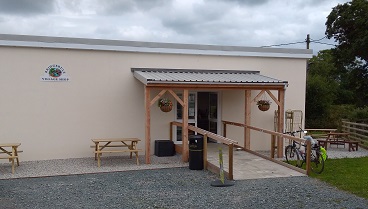 [There is a community-run village shop in Bridgerule (with a coffee machine and outdoor seating). This was opened in early summer 2024 and is staffed by volunteers.
To reach it, turn right (off the NCN3 route) when you reach the T-junction in Bridgerule (about 70m before the bridge) and cycle 200m to the large car park (on your right).
The village shop is in this car park and is open Mon - Sat 8:30am - 5:30pm; it is also open for part of Sunday mornings.]
There is also an attractive detour you can take between Bridgerule and Pyworthy.
Turn right at the second junction after climbing the hill out of Bridgerule (Dux Cross).
This detour (no longer than the NCN3 route) takes you down to go under an old railway bridge then up to the hamlet of Hopworthy.
This detour rejoins the NCN3 route just before Pyworthy.
There is another café, located just north of Holsworthy, that can be reached by taking the first 3/4 of this NCN3 Bude-Holsworthy route as far as Derril. This is The Market Café at Holsworthy Livestock Market. The Bude cycling group often go there for very cost-effective coffee & bacon baps. Wonderfully quiet on Tues, Thur & Fri (9 - 14:30) with lots of outdoor & indoor seating; also Wed (8 - 15) but crowded as that is market day! To get to it, leave the NCN3 route at the junction in Derril and take the route (shown with red dots) in the (diagram of route) link near the start of this Holsworthy section. More details of this café & route to it are given here.
 ----- NCN3 route on to Holsworthy from Pyworthy -----
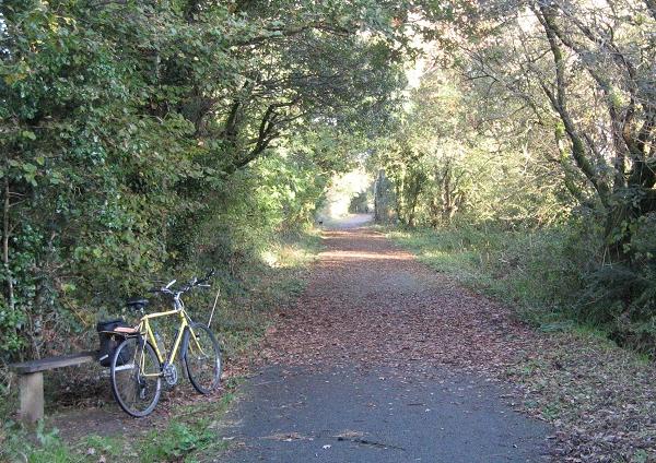
About 1500m east of Pyworthy, watch out for NCN3 signs that point you off to the left down a concreted lane beside a solar farm. This leads down to an old railway bridge where the route goes through a gate and onto the now tarmaced railway track to Holsworthy, crossing over the magnificent Derriton viaduct near its eastern end.
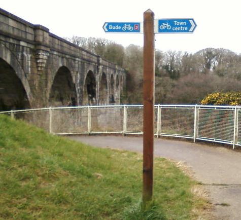 At the end of the spiral route down from the viaduct, you have three options; one is to turn left onto the road (Bodmin Street) and ride up the 300m to Holsworthy. There is a café on the corner at the top and another about 400m further along the road to the left (Fore St) before you get to the church.
Or you could investigate the 'secret' garden, where the Tuesday group often go to consume their coffee. This garden was gifted to the people of Holsworthy and the 'interesting' way to access it is via a narrow arched passageway; you will find the start of this red-brick passageway on the right just after you pass the offset road junction on your way up to the town.
'The Country Dairy & Kitchen', just 100m further up Bodmin Street from this archway, can provide take-away coffee and fresh-baked food (but closes early in the afternoon).
The second option is to take the narrow cycle path that goes to the left near the foot of the spiral. This takes you to residential roads with a signed link (NCN3 in brackets) up to the street leading into the west end of Holsworthy square (lots of shops).
The third option is to continue along the signed eastwards NCN3 route by turning right when you reach the foot of the viaduct spiral and taking the little lane named 'Underlane' that goes left 100m downhill of the traffic lights. This leads to a mini roundabout (which accesses the local Waitrose).
NCN3 (going further east towards the Tarka Trail) continues straight on at this roundabout and leads to a junction with the A388; turn right for a short downhill stretch on the A388 out of Holsworthy (often busy traffic), then a left turn onto the A3072; 300m uphill from here NCN3 goes right onto an eastbound tarmac cycleway on the old railway line.
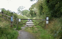
The eastbound cycleway on the old railway line is documented in the 'Holsworthy cycleways' section on the Children's routes page of this website. From a point on this cycleway NCN3 continues on quiet lanes northeast through some delightful stretches of 'Ruby Country' to join the Tarka Trail near Petrockstowe.
[Note, for those who know this eastbound route: Blagdon Wharf Farmshop café used to be based immediately opposite the start of the eastbound cycleway, on the lefthand side of the A388, in a wood-cabin; they moved in late May 2024 to be based elsewhere but have since closed. This page will be updated if/when they have a new location.]
The return route from Holsworthy to Bude
You could return to Bude via the outward route.
An alternative gives a different route back to almost Bridgerule.
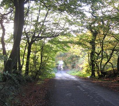 From the traffic lights near the viaduct spiral, go straight down the road into the countryside; ignore the first two roads going off on the right (after 500m and 750m) - both involve very steep climbs.
Instead, follow the road from the traffic lights for over 2km until you come to an offset junction (Thorndon Cross).
Here turn right. Follow this attractive lane (going straight on at the first crossroads) for 2.5km until you come to a T-junction at Bounds Cross.
On your right on this route you will pass the lovely old Pyworthy Rectory and, immediately opposite, a massive tree house.
At Bounds Cross turn right and ride north for 1km to Furze Cross. Here you are back on your outward route; turn left to ride back down to the River Tamar at Bridgerule.
This alternative part of the return route is shown with purple dots in the (diagram of route) link near the start of this Holsworthy section.


Cookworthy Forest
This is another place you can take bikes to ride off-road.
Cookworthy Forest is a huge Forestry England conifer plantation on the A3079 about 4 miles east of Holsworthy. There are a mass of grit-surfaced forestry roads that can be ridden on mountain bikes, hybrids and e-bikes.
Access to the forest is via a grit road that runs north off the A3079 about 2 miles south of Dunsland Cross (where the A3079 meets the A3072). There is a free car park in the forest about 400m up the grit access road (Sat Nav Postcode EX21 5XJ or Grid Ref SS41740166).
The east end of the main west-east forestry road through the plantation continues as a bridleway along the disused railway line to Halwill Junction. It emerges into a quiet close (aptly named 'Beeching Close') opposite the pub, the Junction Inn (Tel: 01409 221239).
There is a 15 mile loop that can be ridden through the forest and via little lanes and bridleways outside the forest. A detailed description of that loop is available (see detailed route description) A GPS track of this loop is available as cookworthy-loop.gpx. This can be viewed against an OS map as described on the GPS files page.
There are other cycling rides in the North Devon 'Ruby Country' area (named after the Ruby cattle in that area). These can be found at http://www.visitdevonsrubycountry.co.uk/ruby-country-activities/cycling/
 Willow Tree Café & Woodland Walk
(longer round trip of about 30 miles)
This is based in the grounds of what used to be, prior to Covid, the Tamar Otter & Wildlife Centre. The area has now been transformed; it has a wonderful café overlooking a very attractive dog-friendly woodland walk trail (open to café customers).
The café is open 10am to 4pm on Thursdays, Fridays, Saturdays & Sundays. More detail is on their website willowtreecafe.org.uk Tel: 07804 342487 Postcode: PL15 8GW.
 Some members of the Bude 'coffee-riders' group occasionaly make this their Sunday destination, as they can rest in the shaded area of the outdoor seating, having earned their enjoyment of some delicious bacon baps.
The most direct outward route to Willow Tree Café is about 14½ miles cycling. It starts on the Bude off-road multi-use trail as far as Helebridge, then on minor roads up to Marhamchurch and on to Week St Mary. The route is signed as NCN3 to Marhamchurch, then NCN304 to and through Week St Mary. There is a community shop and toilets in both Marhamchurch and Week St Mary.
Beyond Week St Mary this route goes south, on quiet lanes, via Greenamoor Cross and Clubworthy, before turning east to descend to the Willow Tree Café.
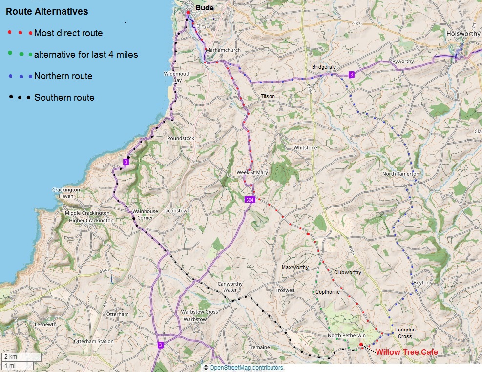
A map showing this shortest route, plus two longer alternatives (& also an alternative option for the last 4 miles of the shortest route) is available here map. All the routes have hills; however, the shortest route is also the least challenging.
A text description (+ a less detailed map) for the 'shortest' route is given here and a GPS track of this route is available as crescent-willowtreecafe.gpx
The alternative option for the last four miles of this 'shortest' route goes via Copthorne and North Petherwin church.
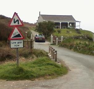
The 'Southern' route (about 18 miles) hugs the coast for quite a distance, with dramatic coastal scenery near Millook (but also two long climbs, one with a 30% section - probably best for those with e-bikes or good hill-climbing ability!). It then runs inland to reach a long scenic lane, which crosses a ford, running down to the River Ottery valley before climbing quite a long ascent up to North Petherwin.
A GPS track of this 'Southern' route is available as crescent-willowtree-south.gpx
The 'Northern' option (also about 18 miles, and with some long hills too) takes the same NCN3 route as the 'shorter' option as far as Marhamchurch, then continues east on NCN3 to beyond Bridgerule (crossing into Devon and over the River Tamar on the way). It then runs southeast to cross back over the River Tamar again near North Tamerton and then continues south to Boyton. From Boyton it crosses the steep-sided Tala Water valley at Talastone before a 1 mile stretch south on the B3254 and then the long descent west towards Willow Tree Café.
A text description for the 'Northern' route is given here
A GPS track of this 'Northern' route is available as crescent-willowtree-north.gpx
These three GPS tracks can be viewed against an OS map as described on the GPS files page. A detailed text descriptions for the 'Southern' route has yet to be completed.

Blackberry Farm Shop (longer round trip of over 30 miles)
Blackberry Farm Shop (Lizzy's Larder) is located on the lane between Milton Damerel and Venn Green, just off the A388.
There is a large airy shop with a tearoom, and a large tea-garden surrounded by farmland and with views of Dartmoor. The food sold in the shop or served in the tearoom is either grown on the farm or sourced locally. See www.blackberryfarmshop.co.uk for more detail / opening times.
The Sunday 'coffee-riders' usually use one of two 19 mile scenic routes when visiting the tea-room (a distance that justifies a 'big breakfast' there for some!).
One route goes north via minor roads to Kilkhampton, then a short stretch on the speed-restricted A39 though the town, then very minor lanes in a loop north of Bradworthy. This avoids the climbs in the valleys of the rivers Tamar and Waldon that would be incurred by a more direct route.
map
Directions for this route are provided (with the map) as crescent-blackberry-north.pdf.
Alternatively a GPS track of this route is available as crescent-blackberry-north.gpx.
This can be viewed against an OS map as described on the GPS files page.
 The other route is a curve to the south, starting on National Cycle Network route 3 towards Holsworthy via Marhamchurch and Bridgerule, then mainly on lanes via Holsworthy Golf Club up to Woodacott Cross and Milton Damerel. map
A GPS track of this southern route is also available as crescent-blackberry-south.gpx. (and detailed directions with a map are being created and will be put up here shortly).
Either of these routes can be ridden in reverse for the return, giving an overall ride of about 38 miles. Additionally, there is a more direct (and shorter - 13 miles) return option by riding the A388 for 1 mile from Venn Green to Waldon Bridge and then a long gentle climb on a minor lane up to Highbarrow Cross and then lanes directly west to Stratton. [Note: this is less recommended as an outward route as the A388 north from Waldon Bridge is a steep curving climb - OK to zoom down but less appealing as a climb with cars bustling past.]


Long distance cyclists
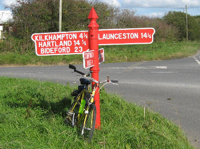 Bude is a convenient overnight staging post for cyclists taking the scenic route up (or down) the west coast of Cornwall and Devon.
Many are doing the 'End-to-End' (Lands End to John o'Groats). Some are cycle-touring in the South West and many are from Europe.
Many of these European cyclists are following the Dutch 'Hart van Engeland Route' illustrated cycle guide that takes them from the Hook of Holland, via Harwich, London, Stonehenge, Bristol and Bude, to Lands End.
 Others are following the European 'VéloWest' branded route from North Devon via Holsworthy, Bude, Bodmin Moor, the Camel Trail, Goss Moor, the Eden Project, Lanhydrock and then back over Bodmin Moor to Launceston, Brent Tor and Tavistock.
Either way, Bude's plentiful supply of accommodation (hotels, guest houses and campsites), shops and restaurants gives plenty of choice to relax after a day of spinning the pedals.
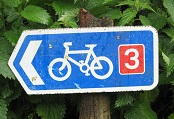 The next morning there are several choices of route onward. NCN3 (National Cycle Network route 3) is one - but there are alternatives, especially going north.
Going North
 One route north, taken by many end-to-enders, with a John o'Groats deadline, is to head straight up the A39 (known and signed locally as 'The Atlantic Highway').
The advantage is no map reading as it is the main road almost all the way. The disadvantage is the fast traffic pushed close to cyclists on several stretches of narrow, double-white-lined road with blind bends. At approx 26 miles from Bude town centre to Bideford, it is only just the shortest route.
The National Cycle Network signed route 3 (also branded with VéloWest logos) is quieter but much longer (approx 45 miles). This goes eastwards on quiet roads via the villages of Marhamchurch and Bridgerule, the town of Holsworthy and the village of Sheepwash before running north to join the Tarka Trail near Petrockstowe, 12 miles from Bideford. NCN3 is shown on Ordnance Survey maps and is not detailed here.
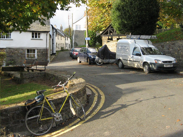
An alternative is a significantly shorter route (approx 31 miles) on equally quiet (or even quieter) roads going east via Stratton, Holsworthy Beacon, Thornbury and Shebbear and then northeast to join the Tarka Trail 8½ miles from Bideford. This is an extremely scenic route.
(see detailed route description)
This route, as far as the Tarka Trail, is also provided as a GPS file (see 'café on the Tarka Trail' box below).
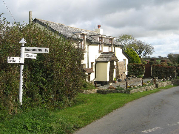 The shortest (and least energy intensive) non-main-road route is to go north from Bude to Kilkhampton (taking the minor road via Poughill & Stibb that avoids using the A39), then through speed-limited Kilkhampton on the A39, then eastwards on very minor roads to join the Bradworthy to Landcross road 9 miles south of Landcross. Thence down to Landcross (the last 7 miles is gently downhill) and then 1½ miles to Bideford on the Tarka Trail.
Just under 27 miles overall.
(see detailed route description) (download GPS file)
|
café on the Tarka Trail Instead of going all the way to Bideford (via the Shebbear and Tarka Trail route - see paragraph before the one above) there is a good rustic-setting café/lunch stop on the Tarka Trail quite near where that (above) route meets the Tarka Trail - at Yarde Orchard café, website: https://yarde-orchard.co.uk. The café is seasonal (for 2026 it opened on 3 April), and may be closed on some days each week, so do check the link for its opening hours. It is 25 miles to get there (when you get to the Tarka Trail, turn right onto it and cycle 1.2 miles south along the trail). To make an interesting loop, return by taking a more southerly 25 mile route that cuts south west on minor-roads/lanes to Dippermill and then follows the well-signed National Cycle Network route 3 via Cookbury, Holsworthy, Bridgerule and Marhamchurch to Bude (with three sections on off-road cycleways). Or go out via the southern route and return via the Shebbear one. GPS tracks of both routes from Bude to Yarde Orchard café are available. These can be used to see the route on a map via free web-based GPS mapping (see the 'GPS track files' section at the foot of this page). |
Going South
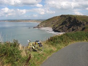 There are two National Cycle Network route options going south from Bude (towards the off-road Camel Trail).
 One option is to take the coast road south from the Crescent car park (signed NCN3). This option has some stunning coastal views before it cuts inland to cross the A39 at Wainhouse corner.
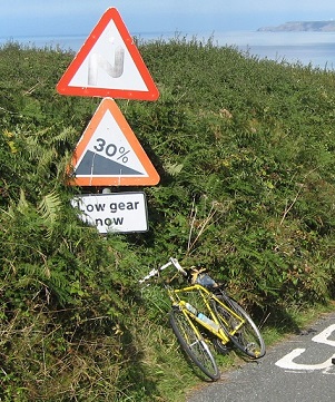 It also gives views of some astounding cliff geology at Millook (geology students visit on field trips).
 However, it also has some quite steep and long hills (notably the one up from Millook - you need low gears for this!) and is exposed to crosswinds in westerly gales.

A closer (bigger) look at the cliff geology at Millook can be seen by clicking the 'Millook Geology link' --->
You can see at the foot of the nearer cliffs the zigzag form of the rock strata, formed during upheavals of the rock millions of years ago.
The alternative NCN route option, especially in wet windy weather, is to take the inland NCN3/304 route. This starts (as NCN3) from the Tourist Information Centre along the canalside cycleway, passing Bude Bike Hire, and on to Helebridge and Marhamchurch.
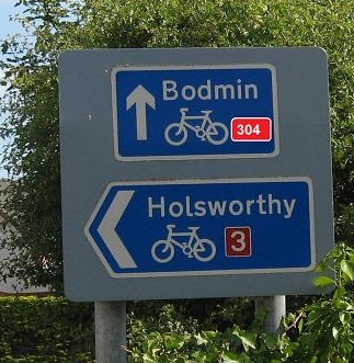 Beside the Bullers Arms pub in Marhamchurch the NCN routes split; turning left here takes you on NCN3 to Holsworthy and then northwards to the Tarka Trail and Bideford; going straight on takes you on the inland southbound NCN304 towards the Camel Trail and Bodmin via Week St Mary.
 This inland alternative possibly involves just as much uphill as the coastal route, but the hills come at you in gentler, more manageable chunks!
The two alternatives join up about 2 miles north of Hallworthy.
After Hallworthy, NCN3 uses narrow quiet roads/lanes up to the disused wartime Davidstow airfield (where there are two museums relating to the war and wartime aircraft), past Crowdy reservoir and over some wonderful moorland terrain before splitting again into two alternatives just before St Breward. The eastern split continues on the moorland (taking in an ancient clapper bridge) to the village of Blisland, with its excellent old pub, and then down to join the Camel Trail at Merry Meeting. The other route descends via St Breward to the northmost point of the Camel Trail at Wenfordbridge. Take your pick!
|
café on the Camel Trail There is a 'log-cabin' café beside the free carpark at the start of the Camel trail at Wenfordbridge; Snailspace Café, website http://www.snailspacecafe.co.uk. This is open for much of the year, but is closed in the Winter months. As at Spring 2025 it was open Tuesdays to Sundays, and closed Mondays. There is also the Borough Arms pub seven miles further south on the Camel Trail, near the point where the spur of the trail running north up to Wenfordbridge joins the part of the trail that runs westwards from Bodmin via Wadebridge to Padstow. This is accessed via a zigzag path up the side of the railway cutting near an old platform. |
For cyclists who are up for a 60 mile excursion, there is a documented ride which uses the inland NCN3/304 route to ride down to the Camel Trail and then returns via minor roads that are closer to the coast. This return does involve a couple of miles on the A39 (to avoid following the coastal NCN3 up the famed northbound Millook ascent!).
(see detailed route description) (download GPS file)
 GPS track files
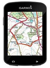
GPS tracks provide a useful, and fairly flexible, way of displaying routes.
Not only can they be used on bike mounted devices (such as Garmin); they can also be used to display the route against a map on a computer, using free websites or free software - or on mobile phones that have mapping apps.
GPS tracks have now been created for many of the routes detailed on this webpage (or in the linked text documents).
These files can be downloaded, then viewed as described above. In particular, there are some websites that enable the track to be displayed against a Google Map (including in 'Satellite' view) or an Ordnance Survey (OS) map
(for example https://osola.org.uk/rides/gpsuploader.html )
All the routes on this website that have GPS files are listed in a table on the GPS files page and can be downloaded from there. That page also gives the link to the free website (mentioned above) that will display such GPS tracks against an Ordnance Survey map.
As elevation data (as well as Latitude and Longitude data) is included in these tracks, some software/apps will also allow you to see how hilly the route is, by providing an elevation diagram of the route.